Although we have been within 20 miles of Portland, Maine--the most populous city in the state--since we arrived in Casco Bay, we have felt far removed from city life. Most of the time over the past three days, I have had one or maybe two bars of cell phone coverage and not enough bandwidth to support an Internet connection from my hotspot. So we have been mostly incommunicado.
After our second night anchored in Cocktail Cove at Jewell Island, we got up early, kayaked to shore and hiked the short distance to the other side of the north end of the island to the Punchbowl, a large oblong body of water separated from Casco Bay during low tide. Throughout Casco Bay, low tide reveals the underlying geology of the area. The rock formations lie in a northeast striking belt from Cape Elizabeth up the coast to south of Bangor, lying in a long linear ridges. This rugged landscape was, over 400 million years ago, a flat stretch of land comprised of volcanic deposits and sedimentation. During the Paleozoic era, in the slow process of plate movements, a microcontinent called Avalonia pushed up against the landmass that later became North America (It was in the southern hemisphere at that time.), creating a syncline. These parallel folds in the earth's surface formed in periods of tectonic movement inspersed with long periods of geological rest as well as volcanic activity. Ice, water and wind have continued to erode the exposed sedimentary and metamorphosed rocks over millions of years, and the softer stones and younger rocks on the crests of the ridges have disappeared, revealing the older rock formations. While standing and hiking on the islands and while navigating up and down the many smaller bays separated by the islands and ledges (It is almost impossible to get to any place as the crow flies.) the troughs and waves of the ancient folds and the northeast orientation of the islands and ledges create a pleasant rhythm to the environment.
 |
| Peter walking by the Punchbowl |
 |
| Young seal at the Punchbowl |
 |
| Meadow and forest by the Punchbowl on Jewell Island |
 |
| Peter near the Punchbowl |
In the Punchbowl of Jewell Island and in tide pools and exposed land at low tide throughout the islands, golden-green kelp lies matted down and a multitude of limpets and snails cling to the encrusted rocks. The kelp fans out and floats as the tide rises, protecting the shoreline and dampening the waves. Surprisingly, we have not encountered fish of any size; we thought that the shallow water would be a nursery, but perhaps the large tidal fluctuations make this impossible. What we did see on the outer rocks of the Punchbowl was a young gray seal, separated from the sea and probably its mother from the open water. I almost did not notice it at first; it had been sunning itself and was dry and the color of its coat blended in with the rocks. Unfortunately, I could not get my phone out of its waterproof pouch to get a photo before it immersed itself in the shallow water.
At 11 a.m. on Friday morning (July15), we pulled up anchor and had a great time sailing a couple hours first on a beam reach, then on a broad reach and then wing and wing, averaging 6 knots of speed in winds up to 12 knots. We passed a treeless1-acre island rising to 40 feet from mean sea level with what looked like from a distance an obelisk. As we drew closer, we realized that the monument on Little Mark Island was a steep square pyramid-shaped structure made of local granite, probably quarried from the island itself, with black lines painted vertically on the faces. The 50-foot pyramid is now a day beacon maintained by the Coast Guard, but it was built in 1827 as a shipwreck shelter. There were three of them constructed in Maine, but this is the only one surviving. The interior of an inner chamber rising to the apex, which was originally open to allow smoke from fires to escape. When in use as a shipwreck shelter, it was stocked with supplies for mariners seeking refuge there.
 |
| Little Mark Island in front of Haskell Island |
Our next stop was in a cove on the northwest side of Yarmouth Island in Quahog Bay. We were surrounded by densely forested islands, open water and lobster pot buoys, near absolutely nothing, which pleased Peter. Me, not so much, particularly since there had been a lack of Diet Coke for nearly two days. It was time to launch the dinghy to search for a store. Getting the grey rubber dinghy ready to go entails winching it up from the foredeck with a halyard and lowering it into the water off the starboard bow; then using the same halyard to raise the outboard motor from the forepeak storage, across the lifelines and into the stern of the dinghy, when Peter climbs down from the gunwale and slips down four and a half feet of freeboard (something I don't think I could do) in order to position and secure the engine to its mounts; and getting the heavy fuel can from a foredeck box and taking it to the swim platform to get it into the dinghy. Peter and I can now manage to complete the whole process in under 15 minutes.
First we motored to a cove on the west side of the farthest east peninsula that makes up the town of Harpswell. (Harpswell is composed of 24 square miles of land and 216 miles of coastline.) Google Maps indicated that it should be a short walk from the dock there to the store on the east side of this finger of land. When we went up the ramp of the floating dock to the higher land, the only person we encountered was a big-bellied man probably about our age standing outside his lobster shack and workshop by his truck and a case of Bud. He pointed in the direction of the store to the east and then told us, "You can't get there from here." He qualified that by stating that we could walk a mile north with a lagoon to our right and then make a 180 degree turn and walk down the other side for a mile. Then, he glanced at his cellphone to check the time and said, "But they're closed now." When we inquired about other places to shop, he shook his head and said there wasn't anything from the water.
Peter had seen a marina on the chart at the head of Quahog Bay, so we dinghied to that destination, arriving around 6 p.m. The marina was small and the boatyard was large, but the only two people around, except for a man fueling up his boat and fishing from the dock (It took him less than a minute to land a big one.), were two women from New Hampshire who keep there boat there and drive up for the weekend. With their local knowledge, they were able to tell us there was a good restaurant right across the road, but it is only open for breakfast and lunch, and a small store lies about three miles away along the paved, two-laned road but they did not recommend walking along it as all the local people are crazy, speeding drivers (in their opinion). The marina did not even have a vending machine for sodas.
Defeated in our efforts, we returned to Mantra, Peter happy in the wilderness and me grumpy without caffeine and carbonation. The highlight of the afternoon was seeing a bald eagle perched on an exposed rocky ledge as the daylight waned. It was a really quiet place to spend the night.
Obviously, we needed to move the next morning. At 10:30, the anchor was up and we proceeded around the southern end of Yarmouth Island, West Cundy's Point and Cundy's Point, finding a lovely spot to anchor near the village of Cundy's Harbor just north of Malaga Island. We had towed the dinghy, so we were ready to set off just after we dropped our anchor. Hallelujah! The small general store, Holbrook's, had Diet Coke in 12-ounce cans and 2-liter bottles. We bought a can for immediate consumption (as well as a bottle of iced tea for Peter) and three 2-liter bottles to take back to the boat. Peter stowed the bottles in the dinghy and we took a stroll down the main (and only) street in the town after having a nice talk with a couple from Phippsburg about the area. The waterfront is lined with working wharfs for lobstermen and fishermen. The street has pleasant houses and an inviting library where we stopped to chat with the two volunteers staffing it that day, learning a bit about the history of Harpswell (in which the village is included).
 |
| View from the restaurant |
 |
| House in Cundy's Harbor |
 |
| Great blue heron ready to take flight |
 |
| Cundy's Harbor waterfront |
Beside the little general store and above the docks, a waterfront restaurant where you order at the window and eat on the large deck beside the water. The restaurant, as well as the wharf, the general store and a large mid-19th century wooden Italianate house have been owned by the Holbrook Community Foundation since 2006. Local people oraganized the foundation and raised funds when the property was put up for sale in 2005, fearing it would be purchased by wealthy people who would not want to preserve it as a working waterfront.
It seems that the lobstermen and fishermen still predominate. There are significantly more working vessels than pleasure craft around Harpswell. Although varying in size and color, the lobster boats seem to be all built along the same lines. The cabin is on the port side and the winch for hauling up the pots is on the starboard beam. That section of the hull often does not have a gunwale and is scarred by the pots being banged and scraped against the side. Often there are pipe structures along the stern and aft port side to keep the traps on board. There are rafts floating in the bays that are used for storing gear, and stacked pots can also be found along the shorelines of the islands, even uninhabited Malaga Island.
 |
| Lobster boats in Cundy's Harbor |
We had lunch at the restaurant, with Peter enjoying a large meal of steamed clams and lobster, strikingly attractive with it flamboyant red shell.
 |
| Peter getting ready to eat his lobster and clams |
Returning to Mantra to refrigerate the precious bottles of Diet Coke, we became surrounded by gray seals, curious and playful. Later in the day, they all hauled out on a nearby rock ledge, and we could hear their mournful-sounding calls all evening. Peter did a call and response with them using his conch shell.
 |
| Seals everywhere! |
We set off for Malaga Island, a previously inhabited island that is now belongs to the Maine Coast Heritage Trust. Of course, the island was used by Native Americans for over 1000 years before European colonization. Then, sometime during the 1860s, a small, racially mixed community was established on the north end of Malaga Island by descendants of Benjamin Darling, a free African-American who owned and resided on a nearby island. By 1900, about 40 people lived in the fishing community--black, white and interracial families--but all 47 were evicted from the island in 1912. Nearby townspeople did not like having them as neighbors; they believed the poor islanders to be inferior. Racism, growing public interest in eugenics and muckraking journalists from throughout the state all fueled the idea that the people on Malaga Island were immoral, degenerate and incapable of being self-sufficient. The State of Maine had a miscegenation law dating from 1821 (the year after the state was created) which stated that no "white person shall intermarry with a negro, indian or mulatto; and no insane person or idiot shall be capable of contracting marriage," so their relationships were shockingly illegal. In addition, economics had an influence on the local communities' and Maine's interest in removing the people from the island, as the property was seen as potentially valuable as a summer resort for wealthy tourists. Declared wards of the state, Malaga islanders were forced to leave their homes by July 1, 1912. Those who could moved their houses to the mainland. The island's missionary-run school was dismantled and relocated for another use on Muscongus Bay. Those buried in the island's small cemetery were exhumed and re-interred at the Main School for the Feeble-Minded. Eight of the former islanders were forcibly institutionalized.
A walk around the northern end, guided by an informative brochure, leads to the foundations of some of the houses and the location of the school as well as stone-lined wells. It is possible to walk around the entire perimeter of the island, through quiet mixed-conifer forest on dried pine needle-cushioned paths. At the southern end, rocks jut out into the water, sparkling with quartz and other minerals, tilted at about 60 degrees, revealing multiple thin layers of metamorphosed sedimentary rocks with granite intrusions. Flotsom had washed up to the high tide line, including a large black trash bag which Peter used to collect and carry out offensive foam, cans, bottles and other garbage.
 |
| Malaga Island |
 |
| Malaga Island |
 |
| South end of Malaga Island |
The next morning, with warmer temperature allowing for shorts and t-shirts, we dinghied up the mouth of the New Meadow River and into the Basin, a large body of water with a narrow entrance and four miles of coastline, a perfect hurricane hole. Past the entrance, the watery surface stretches far and wide, the shoreline punctuated by many coves, the whole area encompassed by the green foliage of evergreens, their tops all pointing into the blue sky. Cut off from the open water, the Basin appears to be a high mountain lake.
We were searching for the trailhead to the Mica Mine Trail. We landed the dinghy in a promising looking cove. I jumped out into a few inches of water to pull it through the mud to dry land and immediately began to sink into the mire. With muck up to my knees, I had to push myself out with my hands, so they also became coated with black, viscuous slime and my shorts and the bottom of my shirt were soaked in the water. I was not a happy camper. As I stood on a rock in the sunshine, after cleaning myself off, trying to dry, Peter went towards the woods to find a trailhead. About 10 or 15 minutes later, he returned. He had not found a trail, but he believed that we could bushwhack our way to the unseen road that would take us there. We could have motored to another cove, but we really did not know exactly where the trailhead was, so that might have not improved things. With me muttering about the situation, the two of us made our way through the underbrush, which was thankfully not dense nor infested with poison ivy, with no horizon or landmark in sight. After about 15 minutes, after climbing up the ridge, we encountered the road. Peter had enough cellphone service to use Google Maps, so we easily found the beginning of the trail, which is part of the Nature Conservancy's Basin Preserve. From the dirt road, winding up the hill, we hiked along a path that became more and more glittery, large chunks and thin slices of mica shimmering among the pitch pine needles. Magical! Soon, the abandoned pit mines, worked in the early 20th century, appeared on our left, the exposed layers still revealing lustrous ore. (There are signs stating that prospecting is unlawful, although it must be tempting.)
 |
| Mica in Sherri's hand |
 |
| Abandoned mine pit |
 |
| Peter and Sherri on the trail |
 |
| Trail covered in mica and feldspar |
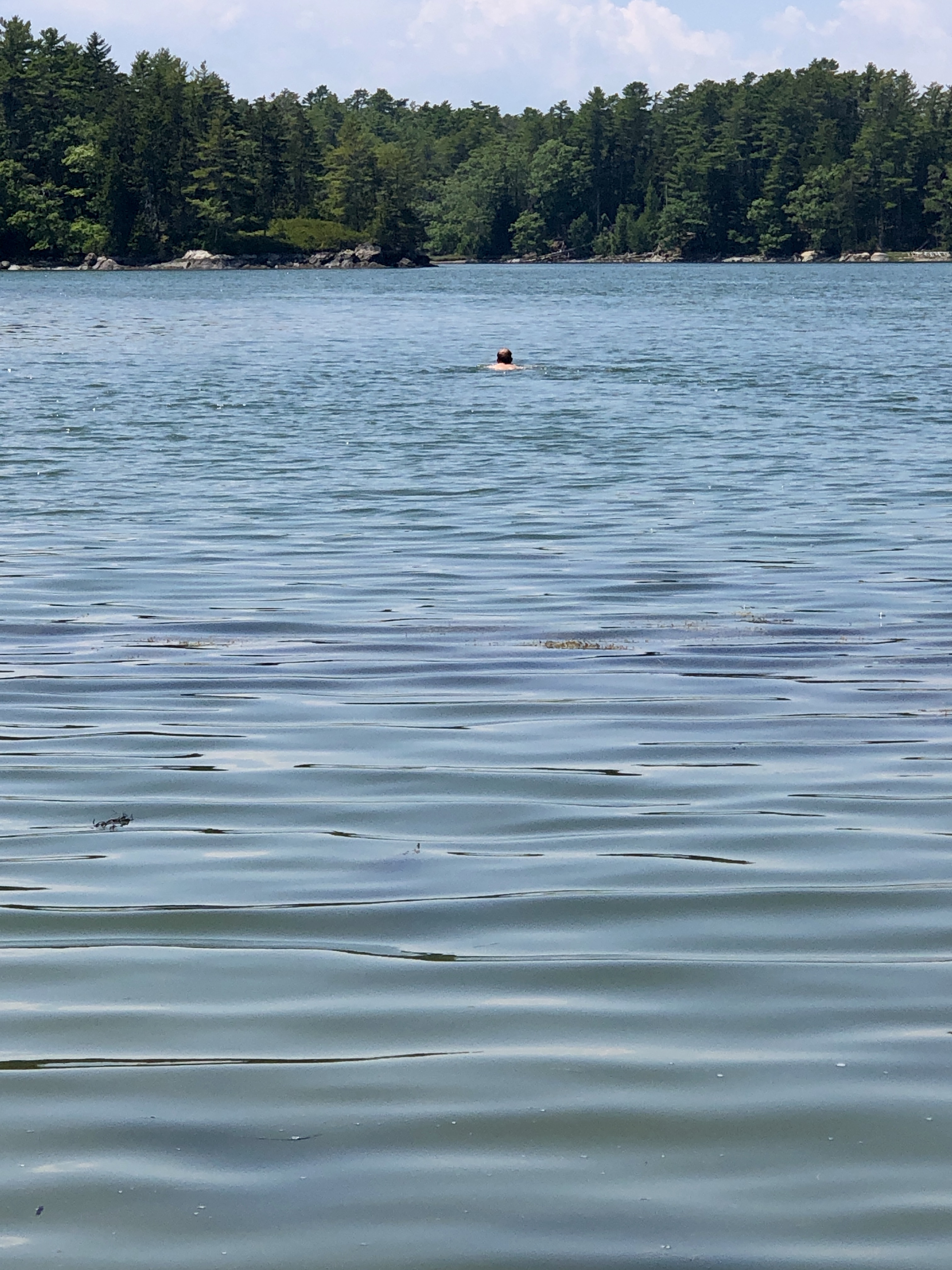
When we returned to the shore, Peter removed his shirt, hat, shoes, watch and glasses and plunged in the bracing water of the Basin to retrieve our dinghy, which was out of sight in the next cove. We did not care to bushwhack back to it, and Peter had some invigorating exercise. We were thirsty, hungry and in need of showers; we chose lunch first. We dinghied past the seal encampment and Mantra to another seafood restaurant, this one across the water from the southern end of Malaga Island, Water's Edge. Peter enjoyed more local catch, scallops stuffed with crabmeat covered with a parmesan sauce. (I had a veggie burger.) We were tempted by and indulged in the desserts, peanut butter pie with an Oreo crust for me and bourbon walnut pie for Peter.
 |
| Peter swimming in the Basin |
After our showers on the swim platform, we pulled up anchor around 4 p.m. and motored around, with no wind, to Pott's Harbor and anchored in Ash Point Cove. Peter has been exploring other options for a mooring ball than the dense field at Handy Boats in Falmouth as a place to keep the boat, with our good friend Enis on board to tend her, while we go to Ocean City, Maryland, for the annual Rodgers beach vacation. As we went by the marina at Basin Point in Harpswell, I noticed that I had no cell service, so that place was nixed because Enis will be working while living aboard and needs connectivity. I think that the reservation I made a few months ago will work just fine.
The air became misty around sunset, and the islands and mainland became smudgy. The moon rising over the pines later at night was a pumpkin orange ball. The mist became dense fog by mid-morning, and a small craft warning is in effect for tonight. With visibility poor, we relied on the GPS and the radar to navigate around Basin Point and then north to the Goslings, two little islands just off the point of Lower Goose Island. The water vapor composing the thick fog condensed into liquid, and it began to rain shortly after we anchored here. Tomorrow, the sun is supposed to return and we hope to expore the Goslings, which are part of the Maine Coast Heritage Trust.
 |
| Mist, Pott's Harbor |
Unfortunately, my connection is not strong enough for photos to be uploaded, so they will appear later.


